
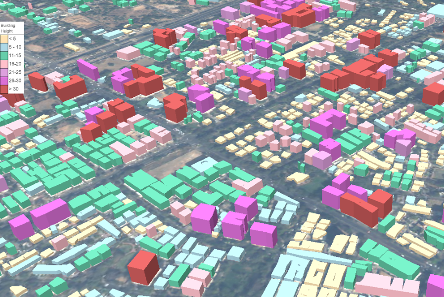
3D City Model
A 3D city model is a detailed digital representation of city’s infrastructure such as buildings in a three dimension scale. It can be used for simulation, impact assessment and analysis of socio-economic plans and natural disaster events. One of the most important application is the estimation of solar potential for 3D roof surfaces of cities, which enables cities to function using renewable sources of energy and take a step towards sustainable development goals.
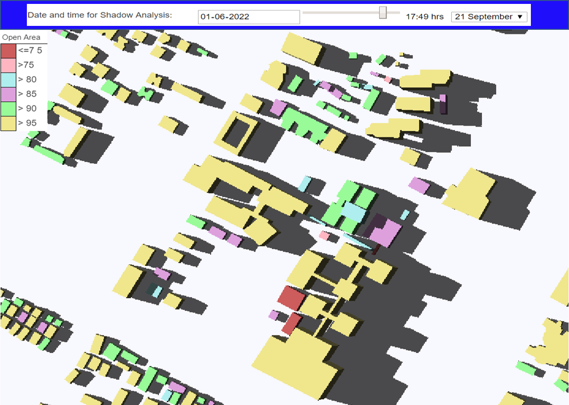
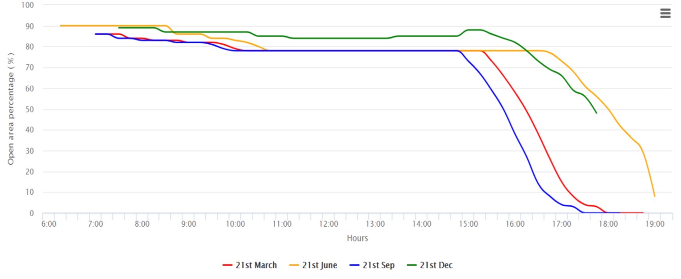
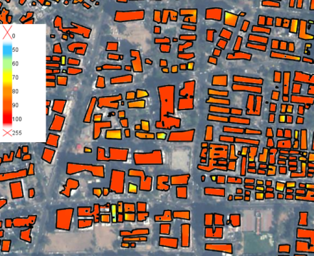
Rooftop Solar Potential
The solar rooftop potential for an individual rooftop is the amount of solar energy that can be installed based on rooftop size, shading, direction, location and construction. The rooftop area available for solar installation and is not under the influence of shadow is calculated using building height, solar, azimuth and elevation angle. It is calculated at every 15 minutes interval from sunrise up till sunset on equinox, winter and summer solstice days. The optimal location of solar panel installation is also derived for identifying areas on rooftop having maximum solar energy available throughout the year. It will be helpful for optimisation of energy generation and usage from solar panels.
3D City Methodology
The model is developed for level of detail (LOD)-1 using very-high resolution remote sensing satellite data. The building footprints in the model are delineated from Indian Cartosat-3 satellite imageries with 1m spatial resolution. It is extracted using Artificial Intelligence based deep learning model trained on huge amount of hand labelled Cartosat-3 pixels data for heterogenous location and types of building distributed in the city. The height of each building is derived from Cartosat-2 stereo pair satellite data with 2.5m spatial resolution. The output are then composited into final representative model for year between 2018 to 2020.