
About HGIS
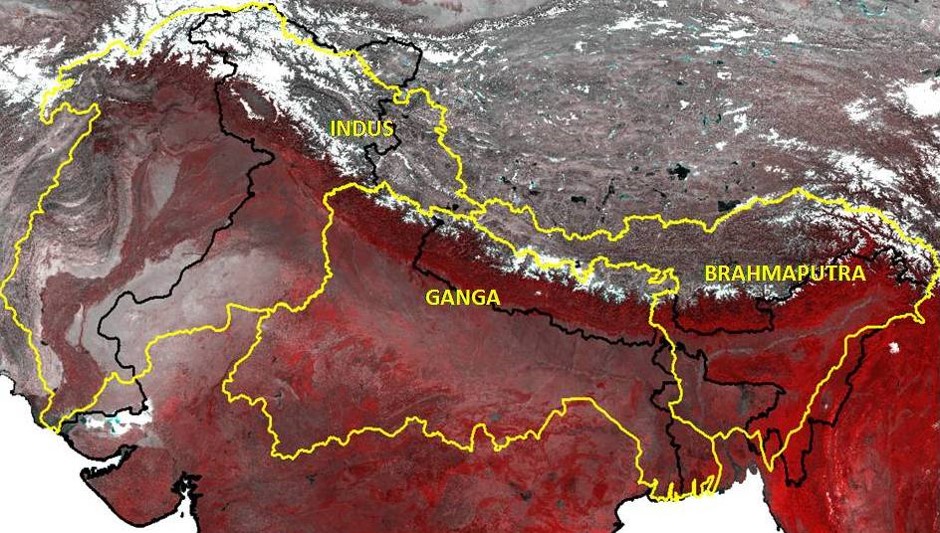
Himalayan Glacier Information System (HGIS) provides baseline information on approximately 35,000 glaciers distributed in Indus, Ganges and Brahmaputra Basins divided into 55 sub basins. These basins cover entire Himalayan region, Trans Himalayan Karakoram and other regions extending within India and adjoining countries like Nepal, Bhutan, Tibet/China, Pakistan and Afghanistan.
The glacier information is prepared using data of Indian remote sensing satellite Resourcesat-I AWiFS of period 2004-07 for all glaciers located in India or nearby regions, which contributes to rivers in India. The Western Indus region is mapped using AWiFS data of period 2007-11.
HGIS represents a significant step towards mapping glacier features and compiling individual glacier level inventory data to fill the void in data and information gap on the status of Glaciers in the Himalaya and Trans Himalayan Karakoram region. HGIS provides a basis for assessing the glacier inventory data which has applications in studies related to climate change, water resource planning, and mitigation of glacial lake outburst flood (GLOF) hazards.
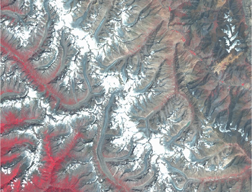
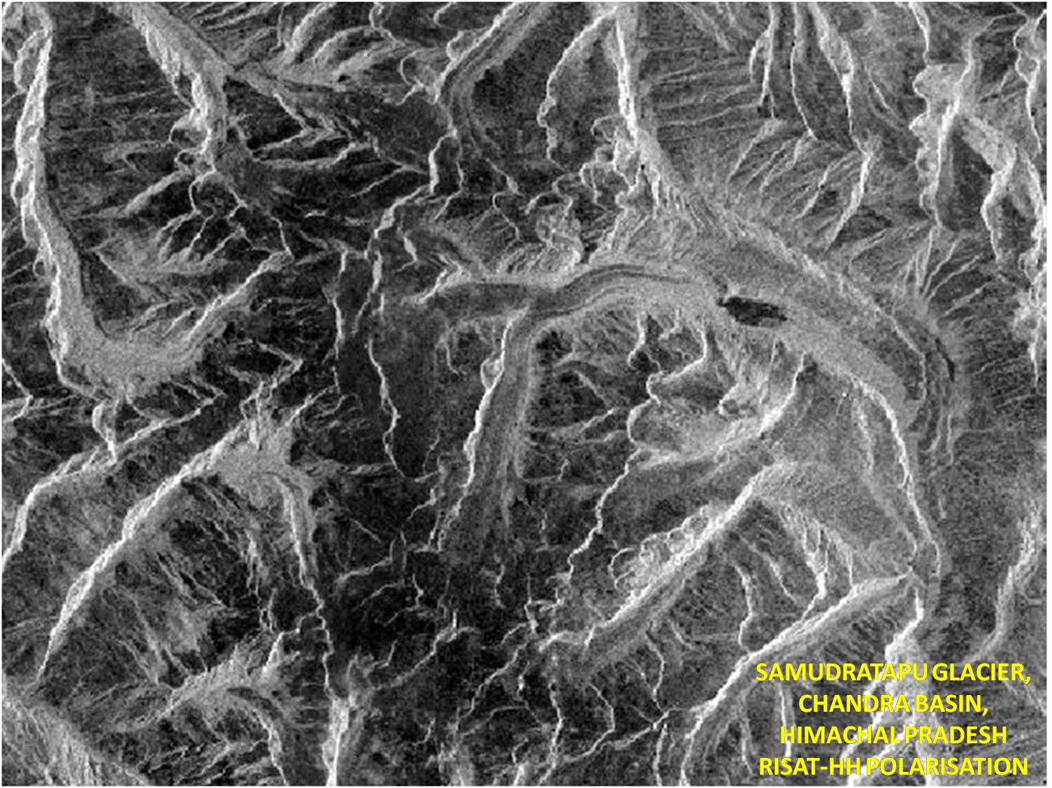
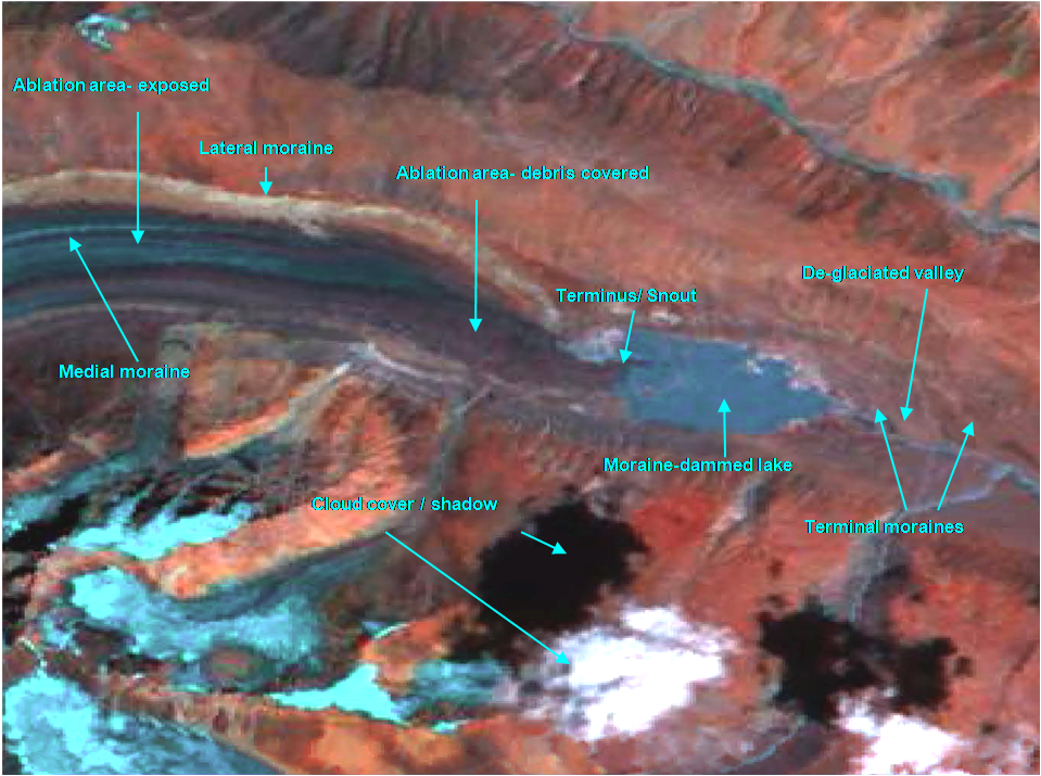
The HGIS information content mainly comprise of 1) glacier inventory maps and 2) glacier inventory data sheet. The glacier inventory map displays the glacier morphology like accumulation zone and ablation (ice exposed and debris covered) zones. The other glacier features like snout location, de-glaciated valleys, distribution of moraines and glacier lakes like supra glacier lake and moraine dammed/ peri glacier lake.
The Inventory data sheet prepared as per global standards provides information on glacier Identification, Dimension, Orientation, Elevation, Classification, etc.
The information system comprises of 4 major functions
1. Display feature for basic layers and selected layers. Some of the basic glacier layers are
- Basin boundary
- Sub-basin Boundary
- International Boundary (not authenticated)
- Glacier outlines (having Glacier Data Sheet attached as attributes)
- Glacier morphology layer
- Glacier snout
- Glacier centre line
2. Smart Filter permits multiple querying on the glacier information within a Basin (Indus, Ganga and Brahmaputra) or any of the 55 Sub-basins.
- Identification number (twelve digits e.g. IN5053M04012)
- Dimension (Area: Glacier total area, Length: Glacier Total length, Ablation length, Mean glacier length and Width: glacier ablation mean width)
- Orientation (Eight direction scale viz. E,W, N, S, NE, NW, SE, SW)
- Elevation (Snout elevation, Snow line elevation, Highest elevation, Mean elevation of glacier
- Classification (Primary Classification and Form)
- Date (Snow line date /satellite pass date1 and satellite pass date 2)
3. Graph generation
- Interactive graph generation based on selected glacier features
4. Map Composition and Printing
The glacier features can be interactively displayed on the monitor and can also be saved as image file. The image file can be printed by using the print icon.