

Metadata
1. Indian International
| Details | Description |
|---|---|
| Base Layer | India,Nepal,Pakistan,Afghanistan |
| Layer Name | India International |
| Layer Entity | |
| Map Base System | Frame Work |
| Map Projection | Geographic |
| Map Datum | D_WGS_1984 |
| Map Datum semi major axis (metres) | 6378137 |
| Map Datum semi minor axis (metres) | 6356752 |
| Map Datum Ellipticity | 298.25 |
| Positional Accuracy(Meters) | 90% |
| Thematic_Accuracy(%) | 90% |
| Elevation Accuracy(RMS meters) | 30 Meters |
| Object Type | Polygon |
| Relevant Date/ Date Range of the Feature | 2004-07 |
2. Basin
| Details | Description |
|---|---|
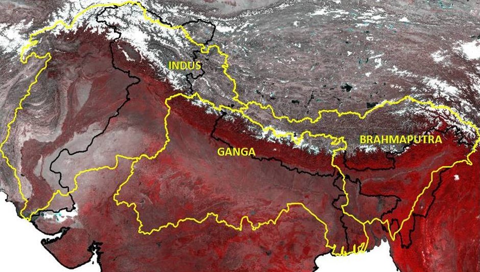
| Base Layer | Indus,Ganga,Brahmputra |
| Layer Name | Basin |
| Layer Entity | |
| Map Base System | Frame Work |
| Map Projection | Geographic |
| Map Datum | D_WGS_1984 |
| Map Datum semi major axis (metres) | 6378137 |
| Map Datum semi minor axis (metres) | 6356752 |
| Positional Accuracy(Meters) | 90% |
| Thematic_Accuracy(%) | 90% |
| Elevation Accuracy(RMS meters) | 30 Meters |
| Object Type | Polygon |
| Relevant Date/ Date Range of the Feature | 2004-07 |
2. Sub Basin
| Details | Description |
|---|---|
| Base Layer | Sub Basin of Indus,Ganga,Brahmputra |
| Layer Name | Sub Basin |
| Layer Entity | |
| Map Base System | Frame Work |
| Map Projection | Geographic |
| Map Datum | D_WGS_1984 |
| Map Datum semi major axis (metres) | 6378137 |
| Map Datum semi minor axis (metres) | 6356752 |
| Positional Accuracy(Meters) | 90% |
| Thematic_Accuracy(%) | 90% |
| Elevation Accuracy(RMS meters) | 30 Meters |
| Object Type | Polygon |
| Relevant Date/ Date Range of the Feature | 2004-07 |
3. Datasheet
| Details | Description |
|---|---|
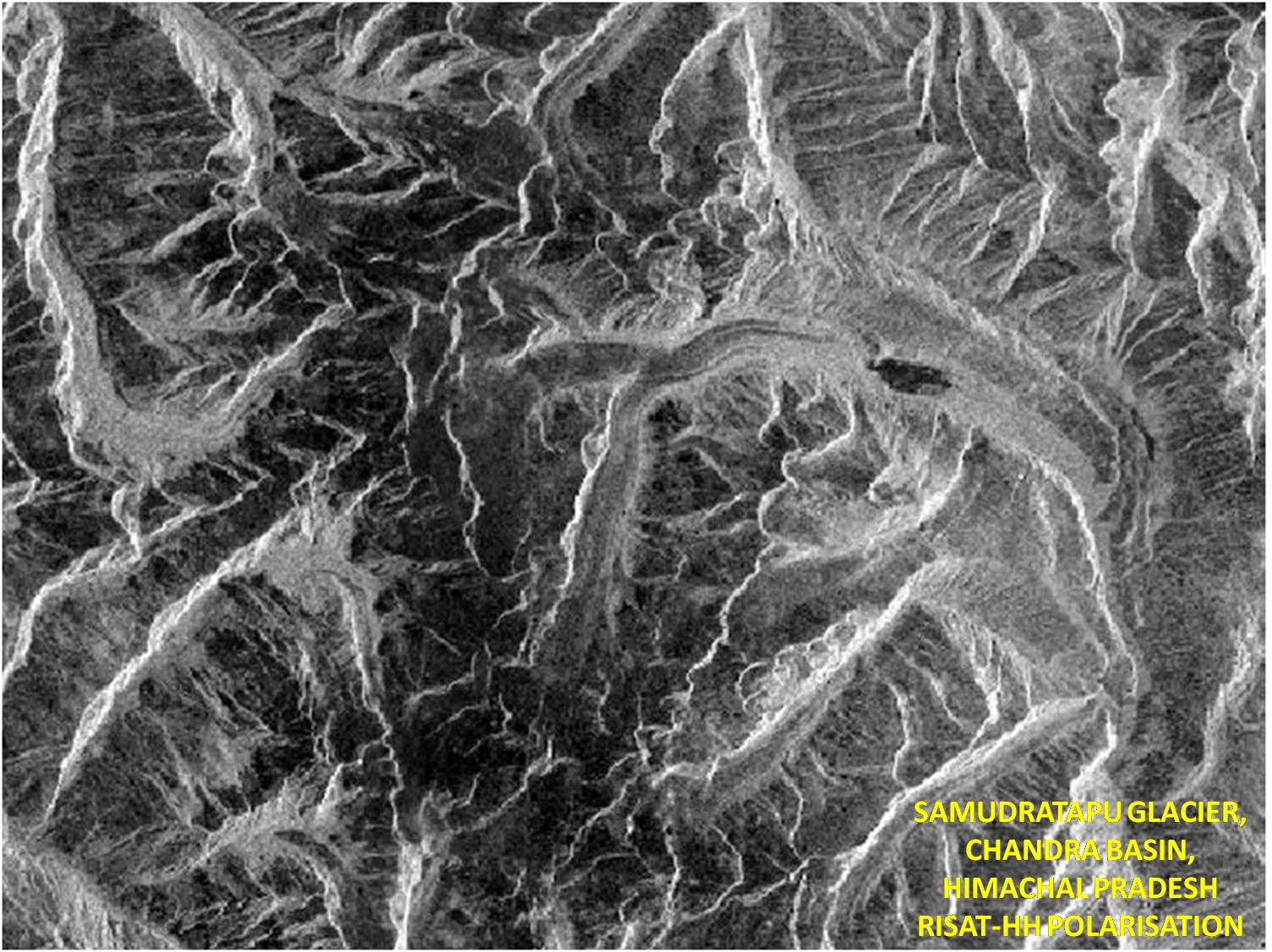
| Base Layer | Glaciers of Ganga Basin |
| Layer Name | datasheet |
| Layer Entity | |
| Map Base System | Frame Work |
| Map Projection | Geographic |
| Map Datum | D_WGS_1984 |
| Map Datum semi major axis (metres) | 6378137 |
| Map Datum semi minor axis (metres) | 6356752 |
| Positional Accuracy(Meters) | 90% |
| Thematic_Accuracy(%) | 90% |
| Elevation Accuracy(RMS meters) | 30 Meters |
| Object Type | Polygon |
| Relevant Date/ Date Range of the Feature | 2004-07 |
4. Morphology
| Details | Description |
|---|---|
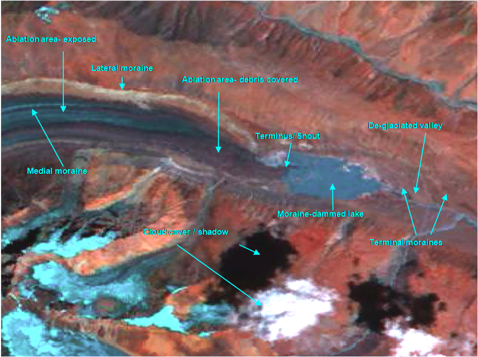
| Base Layer | Morphology of Glaciers in Ganga Basin |
| Layer Name | Morphology |
| Layer Entity | |
| Map Base System | Frame Work |
| Map Projection | Geographic |
| Map Datum | D_WGS_1984 |
| Map Datum semi major axis (metres) | 6378137 |
| Map Datum semi minor axis (metres) | 6356752 |
| Positional Accuracy(Meters) | 90% |
| Thematic_Accuracy(%) | 90% |
| Elevation Accuracy(RMS meters) | 30 Meters |
| Object Type | Polygon |
| Relevant Date/ Date Range of the Feature | 2004-07 |
5. Centeral line
| Details | Description |
|---|---|
| Base Layer | Center Line of Glaciers in Ganga Basin |
| Layer Name | ganga_center_line |
| Layer Entity | |
| Map Base System | Frame Work |
| Map Projection | Geographic |
| Map Datum | D_WGS_1984 |
| Map Datum semi major axis (metres) | 6378137 |
| Map Datum semi minor axis (metres) | 6356752 |
| Positional Accuracy(Meters) | 90% |
| Thematic_Accuracy(%) | 90% |
| Elevation Accuracy(RMS meters) | 30 Meters |
| Object Type | Line |
| Relevant Date/ Date Range of the Feature | 2004-07 |
6. Snout Point
| Details | Description |
|---|---|
| Base Layer | Snout point of Glaciers in Ganga Basin |
| Layer Name | ganga_snout |
| Layer Entity | |
| Map Base System | Frame Work |
| Map Projection | Geographic |
| Map Datum | D_WGS_1984 |
| Map Datum semi major axis (metres) | 6378137 |
| Map Datum semi minor axis (metres) | 6356752 |
| Positional Accuracy(Meters) | 90% |
| Thematic_Accuracy(%) | 90% |
| Elevation Accuracy(RMS meters) | 30 Meters |
| Object Type | Point |
| Relevant Date/ Date Range of the Feature | 2004-07 |